
Weston ZIP Code Coverage
Four main delivery ZIPs are commonly tied to Weston, but they slice the planned city imperfectly. Central and eastern addresses tend toward 33326. Western and northwestern communities tend toward 33327. The 33331 delivery area overlaps southern Weston and nearby southwest Broward, while 33332 serves southwest and western Weston, including the branch library area. USPS delivery routes set the postal code. The city and BCPA maps determine municipal and parcel jurisdiction.
| ZIP Code | Areas Covered | Post Office | Notes |
|---|---|---|---|
| 33326 | Central and eastern Weston, City Hall vicinity and established Bonaventure addresses | Verify by exact address with USPS | Delivery routes, not city law |
| 33327 | Western and northwestern planned communities | Verify by exact address with USPS | Shown on Broward mapping |
| 33331 | Southern Weston and nearby southwest Broward | Verify by exact address with USPS | Includes addresses outside Weston |
| 33332 | Southwest and western Weston, including the Weston Branch Library area | Verify by exact address with USPS | Not identical to the city boundary |
Official research did not identify a definitive station assignment, a Weston PO-box-only code, a unique institutional code, a realignment date, or city population by ZIP. Those gaps should stay visible. Do not turn an unofficial ZIP list into a legal boundary claim. Verify each exact address with USPS, then confirm the parcel in BCPA or Broward GIS.
Weston's Four Delivery Areas
Each Weston ZIP code offers a broad geographic cue rather than a resident roster. The 33326 area points toward the older central and eastern parts of the planned community. The 33327 area is most useful for western and northwestern addresses. The 33331 overlap is the strongest warning against assuming that a Weston postal line equals Weston city jurisdiction. The 33332 area includes the southwest and western side, with a known civic anchor at the Weston Branch Library.
Neighborhood and subdivision names can be more durable than postal assumptions. Indian Trace and Bonaventure are vital search terms for older plans, plats and news. A parcel's folio, legal description, subdivision and lot or block remain stable when mailing formats shift. Once a ZIP narrows the area, those fields should take over the search.
Note: A Weston ZIP code describes mail delivery; use the parcel record to decide which government holds the local file.
Verify Weston ZIPs With USPS
The USPS ZIP Code Lookup is the official delivery check. It accepts a street address when the full location is known and also supports a city-and-state query for broader results. The address result can return the standardized mailing form and ZIP+4. That standardized form is helpful before using an assessor or government request system, where small spelling differences can hide a match.
| USPS mode | Use in a Weston ZIP lookup | Result |
|---|---|---|
| Address | Enter street, city and state | Standard mailing address and ZIP+4 |
| City and state | Review codes associated with the postal place | Broad delivery-code list |
| ZIP code | Check the postal place tied to a known code | City names used for delivery |
The official interface is shown below from the page-specific manifest image. It verifies postal formatting, not Weston municipal limits.
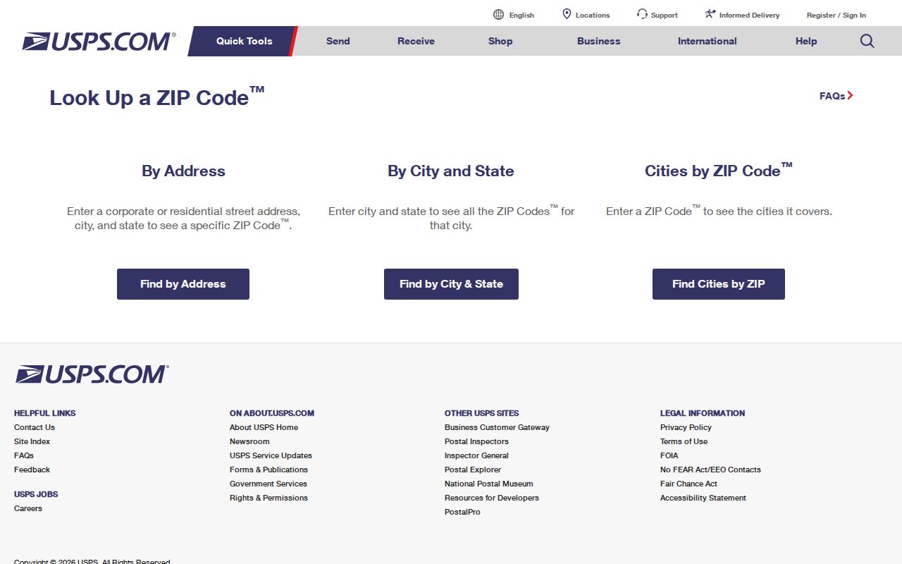
The image marks the proper starting point for delivery data. Follow it with the parcel map when jurisdiction matters.
Find Weston Residents by ZIP
ZIP filtering is a narrowing step. BCPA works best with a full address, owner name or folio, not an assumed citywide ZIP browse. Its GIS includes a ZIP-code layer that can add map context. Broward voter extracts can include public registration addresses and precinct or district fields, but the individual ElectionLink tool is a self-service lookup rather than a way to browse every person in a postal code.
- Standardize the full address and ZIP through USPS.
- Search BCPA by street address and record the 12-digit folio, owner, situs and legal description.
- Open Broward GIS, switch on ZIP and city-limit layers, and confirm the parcel's location.
- Use ElectionLink for an authorized individual check, or request a lawful public voter extract from Broward SOE when that record fits the question.
A Broward voter-list request is distinct from ElectionLink. Public extracts cost $20 per database search in the published research, while protected identifiers and eligible confidential addresses are removed. Participation history never reveals a ballot choice. Once the ZIP code directory has narrowed the area, the Weston street directory carries the work to the street and parcel level.
Weston Folios Beat ZIP Filters
A folio is Broward's parcel identifier. BCPA accepts a 12-digit folio without hyphens, an owner in Last,First form, or a house number and street name. Its parcel panel can show owner, situs, legal description, value fields, exemptions, sale references and a map link. Those data describe a parcel and title, not everyone who lives there.
The folio is stronger than a ZIP because it remains tied to the same legal parcel. A ZIP can change with delivery operations, and a tax mailing address may be outside Weston. The legal description continues to identify the lot, block and subdivision. This is especially useful in a planned city where Indian Trace, Bonaventure and subdivision names appear throughout the record trail.
Map Weston ZIP Jurisdiction
BCPA and Broward GIS provide the second half of the ZIP check. Start from the matched parcel rather than drawing a conclusion from a postal city. The map can show parcels, streets, city limits, ZIP codes, subdivisions, zoning, flood zones, census tracts and other civic layers. Save the folio and click the parcel detail for the exact legal identity.
Weston published a 2025-2026 official street map and guide, a timely local reference for current address geography. It can orient a reader among streets and delivery areas, while the live parcel map should settle jurisdiction. Planned technology improvements and GIS datasets may change the portal interface, so recheck field labels before relying on old screen directions.
Note: Use maps to locate the record keeper, then use the keeper's index for the person or parcel evidence.
Weston ZIPs Versus City Limits
USPS assigns codes for efficient delivery. Weston governs within its legal boundary. These systems can overlap without matching, most clearly in 33331 and in the broader southwest Broward delivery geography. A postal city name does not decide whether Weston City Hall, another municipality, or Broward County is the proper custodian for a permit or code file.
- ZIP vs ZIP+4
- A ZIP is the five-digit delivery area; ZIP+4 narrows mail to a smaller delivery segment.
- PO-box ZIP
- A code reserved mainly for post-office boxes rather than ordinary street delivery.
- Unique ZIP
- A code assigned to one high-volume organization. Research found no verified Weston example.
- Carrier route
- A set of addresses served along one postal delivery path, not a city boundary.
When the maps disagree with a typed postal label, trust each source only for its own job. USPS governs delivery. BCPA identifies the parcel. Broward GIS shows mapped jurisdiction. The city or county custodian then answers the records request. This division keeps a ZIP code lookup from sending a permit, voter or property question to the wrong office.
Privacy in Weston ZIP Searches
A ZIP-wide search does not create a right to private household data. BCPA shows titled owners, not all occupants. ElectionLink is an individual tool, while public voter extracts omit confidential identifiers and eligible protected addresses. Utility, delivery and motor-vehicle data are not public resident directories. Florida's Address Confidentiality Program can shield an eligible participant's residence across agencies.
Use postal and parcel records for family history, civic questions, scam checks or lawful property research. Do not use a Weston ZIP code directory to track, threaten or harass anyone. If an official record is wrong, request a correction from its custodian rather than spreading the error through a commercial compilation.